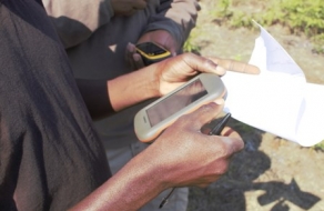
In the struggle to protect and manage the world’s fragile conservation areas, it is essential to make use of the best technologies available. With the value of illegal wildlife products increasing, poachers are becoming more and more sophisticated in their methods. Providing accurate information on their activities and monitoring the effectiveness of law enforcement patrols is essential to combatting this scourge.
Developed by a group of experienced conservation practitioners, the Spatial Monitoring and Reporting Tool (SMART) is a state-of-the-art tool for measuring, evaluating and improving the effectiveness of patrols and site-based conservation activities.
Mozambique has recently decided to incorporate SMART into its arsenal of weapons against poaching. The plan is to trial the programme in three of the country’s national parks, Limpopo, Bazaruto and Niassa. Eventually it will be rolled out in all 12 of the conservation areas, with a centralised database in Maputo.
The first training event, sponsored by the National Administration of Conservation Areas (ANAC), took place at Limpopo National Park (LNP) headquarters in Massingir. Senior staff from LNP and other parks attended the course, with a view to implementing SMART.

As Helder Mandlate, a senior ranger from LNP, said, “The lack of a database makes it difficult to easily exchange information with our partners. At the moment everything is done manually. With the creation of this system, everything will be facilitated”.
One of the trainees from Bazaruto Archipelo National Marine Park echoed these sentiments: “We have a lot of data on the management of marine fauna which, at the moment, is cumbersome to manage and might easily get lost or become badly organised.”
The initial training focused on setting up and managing the database in each of the three pilot parks. Further training is planned for the field rangers to collect the data.
Story by Valdemar Casimiro
Limpopo National Park

